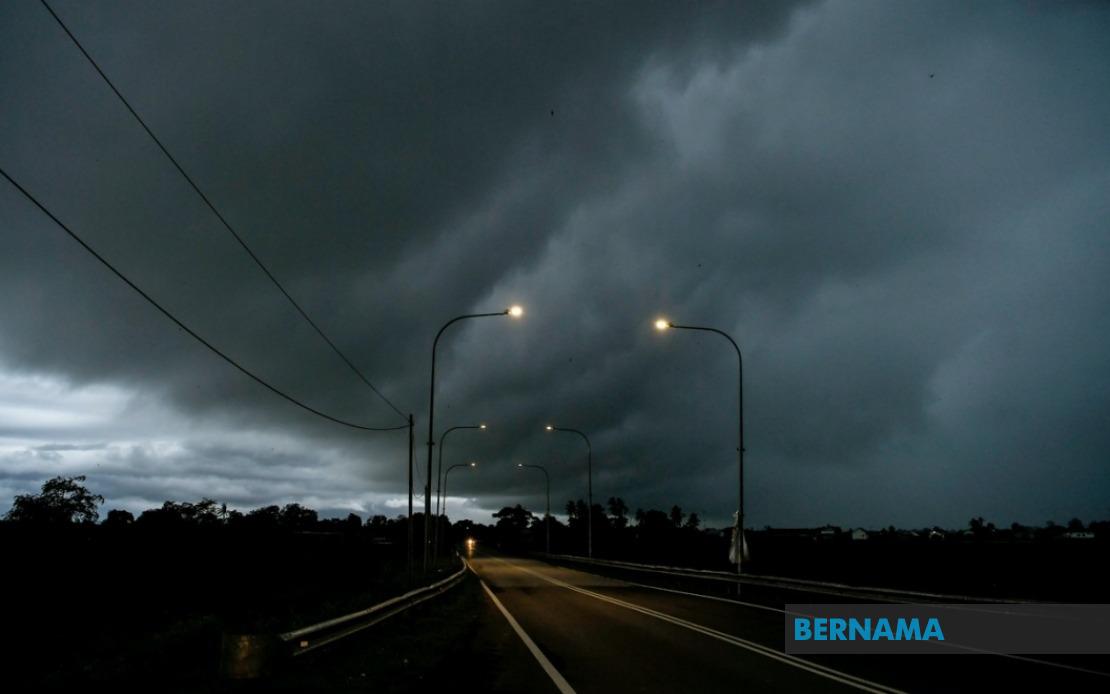
The Malaysian Meteorological Department has activated a comprehensive weather alert spanning nine states and the Federal Territory of Labuan, cautioning residents of impending thunderstorms, torrential rainfall, and gusty winds that will remain in effect until 9 pm today. The widespread warning reflects the severity and geographic scope of atmospheric conditions currently affecting the nation, with meteorologists detecting instability across multiple regions that could trigger sudden and intense convective activity.
In the northern peninsula, the entire state of Perlis falls within the warning zone, placing all residents in this region on high alert. Kedah's coastal and inland districts have also been flagged, specifically Langkawi, Kubang Pasu, Kota Setar, Pokok Sena, Padang Terap, Sik and Baling. Perak's more densely populated areas including Kerian, Larut, Matang and Selama, Kuala Kangsar, Kinta and Kampar have likewise been included in the advisory, indicating that significant portions of the Klang Valley's neighbouring state face potential disruption.
The central peninsula shows scattered vulnerability, with Pahang's highland and eastern zones—Cameron Highlands, Bentong, Bera and Rompin—singled out for monitoring. Selangor's Hulu Langat district, which covers residential areas and recreational zones popular with weekend visitors, remains under alert status. In the southern interior, Negeri Sembilan's Jelebu and Jempol divisions face similar conditions, whilst Johor's eastern and southern districts of Segamat, Kluang and Mersing have been included in the warning perimeter, affecting a region that includes significant agricultural and plantation areas.
East Malaysia's situation is equally concerning, with Sarawak experiencing the most extensive coverage of any state. The warning encompasses Kuching's peripheral zones including Bau, the diverse district of Serian, and the Samarahan division covering both Samarahan and Asajaya municipalities. Sarikei's Meradong area, the division of Sibu, and Mukah's Tanjung Manis region are all included, alongside the interior divisions of Kapit (Song and Kapit), Bintulu (Tatau and Sebauh), Miri (Marudi) and Limbang. This represents substantial coverage of Sarawak's populated and economic zones.
Sabah has likewise received a broad alert encompassing multiple regions. The interior divisions including Sipitang, Kuala Penyu, Beaufort and Tambunan face heightened risk, as do the west coast districts. Sandakan division, covering the northeastern portions of the state including Tongod and Kinabatangan, has been flagged for potential severe weather. The simultaneous warning across both East Malaysian states suggests a significant weather system is influencing vast portions of the island of Borneo.
The timing of this alert, with the warning extending through the evening hours until 9 pm, suggests that the atmospheric instability is expected to persist through the latter part of the day before conditions potentially ease overnight. Residents in affected areas are advised to exercise caution during this period, particularly those engaged in outdoor activities or driving through affected regions. The combination of heavy rainfall, strong winds, and lightning poses multiple hazards, from flash flooding in low-lying areas to debris hazards from wind damage and reduced visibility on roadways.
Thunderstorm warnings of this geographic breadth typically indicate the presence of organised convective activity or a larger weather system moving through the region. The Malaysian Meteorological Department's issuance of such a comprehensive alert reflects meteorological data suggesting genuine risk across these disparate zones rather than isolated storm cells. The concentration of warnings in both northern and eastern peninsular Malaysia, coupled with extensive East Malaysian coverage, suggests atmospheric conditions affecting a large portion of the country simultaneously.
For transportation networks, the simultaneous warning across such a large area warrants coordination among highway authorities, flight operations, and maritime services. The inclusion of highland areas such as Cameron Highlands and interior Sarawak divisions, combined with coastal zones like Langkawi and Labuan, indicates that diverse terrain and elevation zones are expected to experience significant weather impacts. Flash flooding represents a particular concern in low-lying coastal areas and river systems, whilst elevated zones may experience particularly strong wind gusts.
Public agencies and emergency services in the affected states and divisions should maintain heightened readiness through the evening period. The widespread nature of this alert means that demand for emergency response services could be distributed across multiple locations simultaneously, potentially straining resources. Communities in the warning zones are advised to monitor official weather updates closely and follow guidance from local authorities regarding any necessary precautions or evacuations.